After Over 2000 Miles, Record Attempt Ends Less than 150 Miles from Finish Line

NEW ORLEANS – Alpine Shop employee, Perry Whitaker, set out in early May as part of a four man team attempting to set a new World Record for Fastest Time to Row the Length of the Mississippi River by a Team. 16 days later and less than 150 miles from that record, the Mississippi Speed Record canoe swamped and sank due to a life-threatening mix of high winds, ocean-going vessels, barges and tugs all converging on the river at the same time.

Perry posted on Facebook, the morning after the canoe vanished into the waves: “Our canoe is at the bottom of the Mighty Mississippi. This adventure is done, after over 2,100 miles.”

A little later he added to that:

I’ve been on lots of crazy adventures, but this is the first time I’ve ever had more than just a few people cheering for me as I was adventuring.

For more than 2,000 miles over about two weeks, people have lined the River to encourage us. They’ve cheered, war-whooped, blew horns, shot fireworks, and rang cowbells.

Lots, and lots of cowbells…

There were crowds cheering as we paddled through cities, people waving from their back yards, groups partying at isolated boat ramps, and sometimes we had absolutely no idea where the cheering was coming from.

At a few very small, BEAUTIFUL towns along the River, it seemed that a majority of the residents were out there encouraging us.

Cheering for me??? I can’t wrap my brain around strangers cheering for me because I’m just a regular guy.

Unfortunately, with less than 150 miles to go, my River humbled us.

Heavy winds swamped our canoe in the middle of the night and we lost everything in a few short minutes.

I had a firm grip on the safety boat, and I struggled to hold on to the canoe as long as I could until the current took her down.

I’m pissed.

I’m sad.

I’m disappointed.

But mostly, I’m astounded that so many people took time out of their busy lives to encourage and support me in this little adventure, and I’m very, very appreciative of everyone.

Not just the crowds along the river, but also the couple dozen outstanding people who volunteered about three weeks of their time to try to make this whole thing a success.

This is not hyperbole, but I think more highly of people today than I did before this trip.

Perry Whitaker – May 21 on Facebook

After he took a few days to make his way back to work at Alpine Shop, here’s how Perry answered some of the most frequently asked questions about the trip:

Q. Why in the Hell did you do this?

“Because it’s there”. Someone once asked Mallory why he wanted to climb Everest and he said “Because it’s there”.  Paddling the whole Mississippi in less than 3 weeks isn’t nearly as daunting as climbing Everest. Mallory died on his third attempt at Everest, we just sunk our canoe and had to be rescued by our safety boat. 

I met Conrad Anker a few years ago, he’s the person who finally found Mallory’s body about 75 years after he died. I got to buy a few beers for the guys in the safety boats who rescued us, Mallory didn’t get that option.

I’ve given a lot of presentations about the history of the Mississippi River so I was excited when I got the opportunity to join this team on the record attempt. 

Q. Have you ever done anything like this before?

I’ve been on lots of adventures, but nothing like this. 

I went on a month-long solo bike trip through Central America, I walked across England along Hadrian’s Wall then biked across Ireland, and I’ve been on a lot of other long backpacking, biking, and paddling trips.

This was the first time I tried to break a Guinness Book of World Records time for something.

Q. What was your most memorable moment of this trip?

You mean other than the canoe sinking in a storm 137 miles from the finish? 

The first 2,160 miles of the trip were great, but the last few minutes kind of sucked. 

I really enjoyed all the wildlife. We heard a pack of wolves, saw a couple bears, some sandhill cranes, and we watched a huge fisher jumping out of a tree after something. I wish I had taken a bird identification book with me, even though I was too busy paddling to look up birds.

Q. What did you expect to be your biggest challenges of this trip and were you right? 

I think my expectations were pretty close to reality. There were two categories of challenges: those things we could control and those things we couldn’t. The things we could control included training and equipment, the things we couldn’t control included things like the weather, or a major barge traffic jam caused by a damaged bridge in Memphis, TN. I expected the physical challenge to be my biggest hurdle, so I trained pretty hard. I was also worried about how much this would cost. We expected it to cost between $20,000 and $30,000 dollars.

Q. Twenty to thirty thousand dollars?

We had a huge support crew. There were three safety boats and two RVs following us down the river. The primary costs were fuel for those vehicles and food for about 25 volunteers for about 3 weeks. There was also the price of gear. The canoe was about $3500, modifications to the canoe was another grand, paddles were about $300 each. There were a million other things we needed and they all added up.

Q. Tell me about your training for this.

For the past several years, I’ve kayak over two thousand miles per year, so I already had a good start on my training. 

In addition to that, I started training on a rowing machine about a year and a half ago. Distance paddling in a canoe or kayak is more about the core than the arms so the rowing machine has been great. I should have worked on my shoulders more, but I did okay. My training was slowed down by the pandemic because I couldn’t go to the gym. 

I think I did pretty well, physically. I felt strong throughout the trip, and I think I could have paddled at that pace for a couple more weeks. 

Q. What was the weather like?

It was below freezing for the first few nights, then it got up to the mid-80’s toward the finish. The weather was surprisingly good until the wind on the last two days. 

Q. I assume this got rather monotonous at times, what kept you going?

I didn’t think it was monotonous, I enjoyed the heck out of it.

When we were forced off the river, I wasn’t joking when I asked if someone could loan me a boat to finish the trip or maybe even paddle about a thousand miles upstream back to St Louis.

Q. As you were on the river, your attempt was covered by a few newspapers and TV stations, while thousands of people were following the progress on Facebook. Were you expecting that? 

Absolutely not. I’ve been on a lot of adventures but I’ve never had thousands of people cheering me on. It was awkward. 

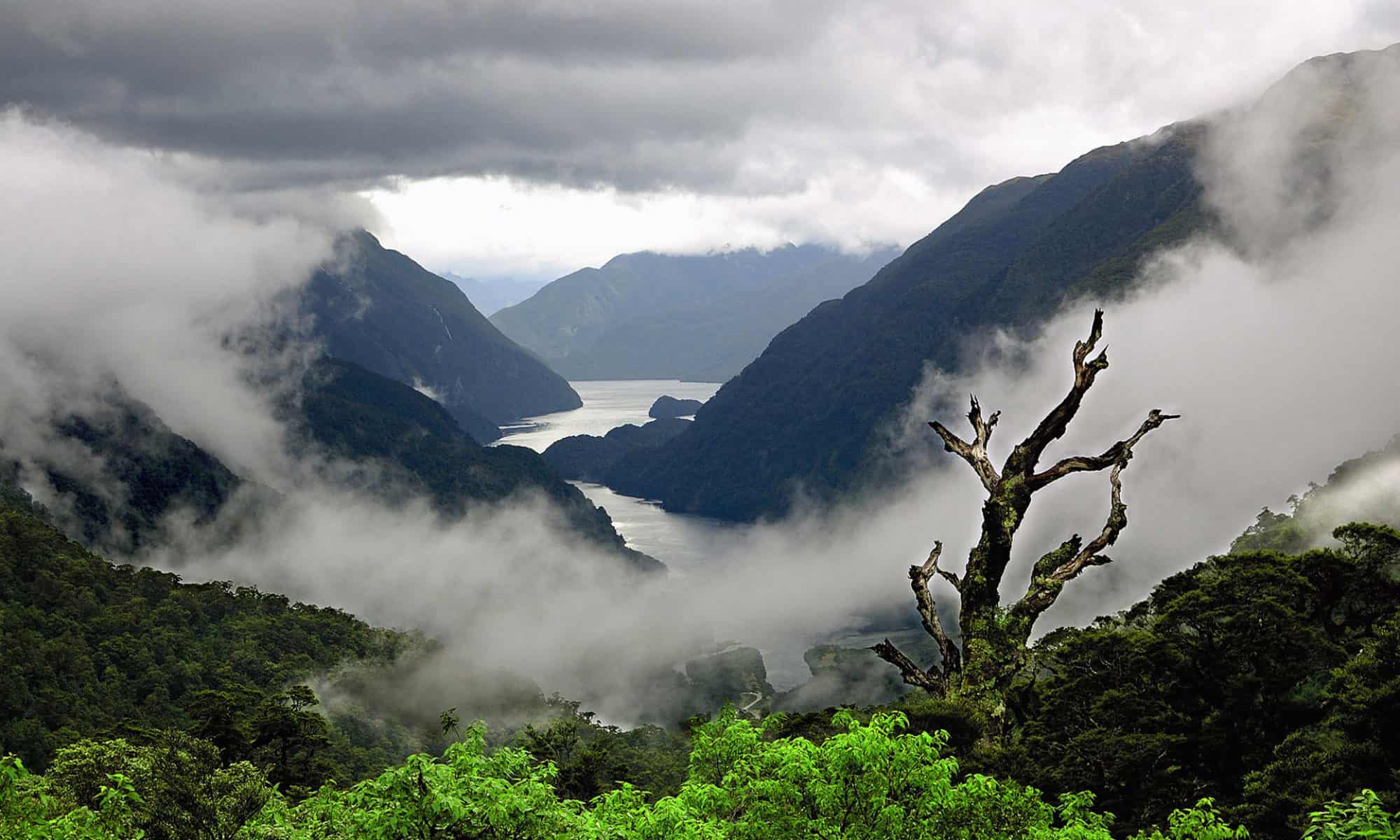
How are the big rivers different from the smaller Ozark streams?

A lot of the upper Mississippi seemed just like paddling on the Current River or upper Meramac. We just saw a lot more eagles and beavers on the upper Mississippi. 

Big rivers like the Mississippi and Missouri are safer than smaller streams in a lot of ways, but more dangerous in others. Paddling on a big river is usually like paddling on a lake, but we don’t worry about barge traffic on our local lakes. Once you understand the concepts of river navigation, it’s pretty easy.  

If you want to paddle on the Mississippi or Missouri, go with someone who knows what they’re doing for the first couple times. It’s simple after someone walks you through it, but it’s difficult and dangerous to try to figure out on your own.

How can people learn more about paddling on the big rivers?

The Mississippi River Water Trail Association is an organization that can really help. Big Muddy Adventures takes people out on the Mississippi all the time, and the Alpine Shop occasionally does too. You can also talk to people who’ve done the MR340, they love to talk about it.

What questions have you been asked the most about this trip?

Getting through the locks, does my butt hurt from sitting in a canoe for 2 ½ weeks, and will I do it again.

What are the answers to those questions?

Locking through was great. There are 27 locks on the Mississippi, and the US Army Corp of Engineers went above and beyond to help us get through them quickly, and some barges even let us lock through ahead of them. That was amazingly cool of them. We only had to wait a couple times. If you haven’t locked through before, do it because it’s very educational.

Yes, my butt was numb.  My hands and feet hurt and were swollen, but people don’t ask about my hands and feet, they just want to know about my butt.  

I’ve had a couple weeks to recover and I’m almost back to normal now. 

You didn’t say if you’d do it again?

I think it’s impossible to do something like this and not think of ways to be faster, more efficient, and safer. I think I could probably knock a couple days off the world record time. I already have the right boat, I just need to find the right people. If I can find the right people, I’ll try it again.

Do you have any other big adventures planned?

The MR340 is coming in a few weeks and I plan to race in that again this year. I’m also thinking about walking the Trail of Tears this winter. 

Any final thoughts or words of wisdom?

I’ve been reading a lot about Teddy Roosevelt recently, and I think more people should read his “Man in the Arena” speech.

2018 KT82 Race Report


Heading East to West from St. Louis to Hermann, Mo., on the 2018 KT82.

On Saturday, June 2, 2018, Alpine Shop employees, along with friends and family took off an an 82 mile relay run from St. Louis County to Hermann, Mo., in the Go! Missouri KT82 Trail relay.

The Leg Chart for the 2018 KT82. Runner #1 has legs 1, 7 and 13; Runner #2 has legs 2, 8 and 14, and so on.

Alpine Shop Marketing Director, Todd Oswald, Bike and Snowsports Hardgoods Buyer Mike Morin, along with outfitters Steve Worthy and Ann Mangin, and Chad Arnett and Sean Badock began the day at 4:45 am to start their journey from Parkway North High School in Creve Coeur, Mo. This is the third straight year Team Alpine Shop has participated in the KT82, which features six different runners each tackling total distances approximating a half-marathon over three separate legs on the longest Rail-to-Trail conversion in the United States – the Katy Trail.

Team Alpine Shop at the Starting Line for the 2018 KT82 Trail Relay. From left: Ann Mangin, Sean Badock, Chad Arnett, Mike Morin, Todd Oswald, Steve Worthy

Summer came quickly to the midwest in 2018. After a mid-April snowstorm kept winter holding on well into our normal spring, Mother Nature switched immediately into deep summer by early May with some of the hottest temperatures ever for the month. By the time the safety meetings for the KT82 happened at the end of May, all participants were concerned with weather reports indicating high temps in the mid-90s for the race.

The day bloomed warm and humid as the team set out from the track at Parkway North, but not overwhelming so, thankfully. By mid-morning, the humidity had reached its saturation point, however, and a race-pausing thunderstorm descended on the more than thousand runners spread out along the course.

The logjam of people at Exchange 7 as we wait for the go ahead to return to the trails.

The traffic jam that developed as the race was forced into a delay by a thunderstorm that rolled through around 10:30 am.

The storm would thankfully keep the temperatures from ever reaching into the 90s, but the cloud cover also dissipated, leaving runners to deal with the sun – and still considerable heat – for much of the afternoon.

The KT82 is a combination of hard physical effort out on the course followed by hours of downtime and socialization in between runs. Then repeat. The race becomes a favorite for many participants, not because of the runs – although the sense of accomplishment is very real – but mainly because of the fun and craziness of putting six people of varying states of exhaustion together in a vehicle for more than 12 hours together (provided you have a good team, I guess, which we’ve been lucky enough to have.)

The scene at Exchange 13 in Dutzow, Mo. At times, the crowds can make it difficult to actually make the exchange!

It’s also a combination of the most social run you’ll ever be a part of as well as the most isolated run you’ll ever do. The Exchange Zones are jam packed with people all day long. On this day, because of the storm, even more teams than usual were at the same exchange zones throughout the day. You become with friends with teams you’re leapfrogging with all day long as certain runners finish faster followed by a slower runner on the next leg. But when you get out on the course, it’s not unusual to have more than a half mile between participants. For runners who thrive on sticking with a pack, it can be an extremely lonely race.

A van full of food and drink for six runners.

The hardest part of the race for many is figuring out what, and how much, to eat and drink throughout the day to keep your energy levels as high as possible for your runs. Unlike a standard marathon where, for many runners, we can cruise on auto-pilot for the middle five to six miles after a three or four mile warm-up, and then just try and hold on for the final 5k; in the KT82, your first leg may be three miles, followed by a two and a half hour wait. Then seven miles. Stretch. Rest for two more hours. Run another five miles.

But as the team makes the final climb up over the Highway 19 bridge over the Missouri River into Hermann and all six runners meet up for the final quarter mile together, the struggles of the day quickly fade in the glow of the celebration at Hermann City Park.

Gear used that is available at Alpine Shop:
Yeti CoolersRoadie 20 Cooler, Tundra 65 Cooler, Hopper 30 Soft Cooler
Altra Lone Peak 3.5 Trail Runners – for single track trail
FITS SocksPerformance Trail Quarter Socks
Chaco Z1 Sandals – for in between runs
The North Face – Better than Naked Running T-Shirts
Alpine Shop Off-Road Racing League Race Shirts
Salomon Speedcross Trail Runners
Hoka One OneChallenger ATR 4
Saxx 2N1 Kinetic Run Shorts (not yet available at Alpine Shop, but check back soon – they’re awesome!)

Find the Best Adventures Near You with Alpine Shop & RootsRated

Outdoor guide site RootsRated is set to launch in partnership with Grassroots Outdoor Alliance retailer Alpine Shop this week to provide locals and visitors to the St. Louis area with a highly usable guide for discovering local experts’ favorite places for outdoor recreation.

RootsRated is, simply put, an outdoor travel guide. Ever find yourself traveling to a city, wondering where you can rock climb or trail run when you get there? Are you new to your area, or looking to try a new sport? With RootsRated, the best local outdoor experiences are at your fingertips.

This is “expertly-curated” information, which means our local experts have selected their favorite spots for you. You won’t have to wade through dozens of options before making a choice; the 5 or 10 best local spots are right there, so you can pick one and get out there. If you need a piece of gear before heading out, you’ll be able to connect with Grassroots Outdoor Alliance retailers in that region — the same experts who’ve provided the content.

Here’s what Alpine Shop Marketing Director Todd Oswald had to say about the project:

“We’re already a hub of local knowledge for trails, paddling routes, and crags in the St Louis and Columbia regions. RootsRated will give us an innovative way to become the digital hub as well. We’re looking forward to giving our customers another resource to help them get outside themselves.”

RootsRated is going to empower adventurous people to find the most memorable experiences; this platform is the perfect resource for those in search of authentic local knowledge. Find your favorite local places to go and things to do with www.rootsrated.com.


Outdoor Nation – an Alpine Shop Employee Experience

Outdoor Nation

Outdoor NationOutdoor Nation was a unique and exciting experience.  The 2011 summit I attended took place in St. Paul, Minn. at the University of Minnesota – St. Paul and included about 95 young people ages 16 – 28 from all across the Midwest.  While the majority of participants were from the Twin Cities-area there was also a large group of high school students from Chicago and representatives from as far away as Texas!

Issues and Concerns

We began the summit discussing obstacles that prevent youth from spending time outside.  The issues brought up ranged from  safety concerns in inner cities, to lack of outdoor education in school curriculum, to the rising dependence on technology.  We discussed our concerns in broad terms, and through a series of 6 person discussions, followed by large-group votes, narrowed down our broad topics to specific issues we, as a whole, wanted to address.  From these specific issues we broke into several small groups to come up with program ideas that we could then implement, and the top four ideas received seed money provided from Outdoor Nation to put their plans into action!

Decisions and Developments

It was neat to be involved in the decision process that lead to implementable, outdoor, youth programs.  The four ideas chosen were all excellent and spanned a broad range of topics including: helping start community gardens, mentoring elementary and high school aged youth and trying to influence political leaders. The majority of the participants were from Minneapolis area, so all the programs developed were for that area, although each has the potential to expand to include other regions in the Midwest.

In addition to seeing the existing programs grow, I hope the summits move to new cities each year so they will continue to get a diverse group of participants and expand the reach of their programs throughout the country.  I am very glad to have had the chance to participate in this program and to be involved in the initiatives that resulted from the summit, I am excited to see it grow in years to come!

-Liza Babbington
Outfitter – Alpine Shop Columbia

5 Best Non-Paddling Destinations in the Ozark National Scenic Riverways

Round Spring in the Ozark National Scenic Riverways

Over a million people a year visit the Current and Jack’s Fork Rivers – otherwise known as the Ozark National Scenic Riverways, part of the National Park system – to partake of the amazing natural beauty of the area. The vast majority of those visitors float the streams in canoes, kayaks and rafts. However, paddling is far from the only attraction this park offers to outdoor types. It also offers caves and springs, trails for hiking and horseback riding, camping and even some cycling. In fact, it is quite possible to have a week-long trip in this beautiful national park and never take to the water.

Below are Alpine Shop‘s five best non-paddling destinations to round out your visit to the ONSR.

Round Spring in the Ozark National Scenic Riverways
Named for not only the circular shape of the spring opening, but also for the almost curved appearance of the water, Round Spring is a must-see on any trip to the Ozark National Scenic Riverways.

1. Round Spring & Cave

Located on the upper section of the Current River, Round Spring is a delightful place to visit. The surrounding terrain and mineral content of the water makes the flat surface appear to be curved and the spring opening is almost perfectly circular, thus the name Round Spring. Round Spring adds an average of 33 million gallons of water to the Current River each day. The beautiful spring branch flows under a short tunnel while making its way to the river. This area was one of Missouri’s first State Parks (1932) prior to its inclusion into the national park in 1964. (Note: people are not allowed to swim or wade in Round Spring.)

Nearby is the extremely beautiful Round Spring Cave. The National Park Service offers guided tours by lantern from Memorial Day to Labor Day. There is a small charge for the tour ($5 for adults and $2 for kids) and participation is limited to the first 15 people to buy tickets. These tours are offered daily at 10 am and 2 pm. Tickets go on sale 30 minutes before each tour. While there are over 300 known caves in the park, Round Spring Cave is the only one open to public tours.

Rocky Falls - Ozark National Scenic Riverways
One of the most beautiful waterfalls in the Ozarks, Rocky Falls is the perfect destination for a summer afternoon.

2. Rocky Falls

This 40 foot wide cascade is one of the best waterfalls in the Ozarks. Some water flows year-round, but in the spring and after heavy rains will give you the best view of this amazing geologic formation. The falls are located about 22 miles east of Eminence, Mo. off Hwy H. The area includes pit latrines and a small picnic area. The plunge pool below the falls offers a great place for a swim during the hotter months.

Blue Spring - Ozark National Scenic Riverway
Over 300 feet deep, Blue Spring more than lives up to its name.

3. Blue Spring

Blue Spring, called “Spring of the Summer Sky” by native Americans, is over 300 feet deep. This amazing depth gives the spring its brilliant sky-blue coloration. The area is reached by a gravel road off Hwy 106 east of Eminence, MO and features a picnic area and restrooms. This spring is best visited before the afternoon sun casts its shadow on the spring pool.

Big Spring - Ozark National Scenic Riverways
One of the most popular areas in the Ozark National Scenic Riverways, Big Spring pumps an amazing 246 million gallons of water each day into the Current River.

4. Big Spring

Big Spring is the one of the largest single outlet springs in the world pumping out over 246 million gallons of water on an average day. This amazing site offers picnic grounds, cabins, a dining lodge, and campground. The beautiful spring branch flows about a half mile to the Current River. Big Spring is located just outside of Van Buren, MO.

Klepzig Mill & shut-ins - Ozark National Scenic Riverways
A little-known glimpse into the past, Klepzig Mill will bring you back to 1928, the year the mill was built.

5. Klepzig Mill and Shut-ins

Located downstream from Rocky Falls, Klepzig Mill and Shut-Ins is one of the hidden gems of this National Park. You can find this seldom-visited place by following a somewhat rough gravel road (County Road #522) that heads to the left where the pavement ends on Highway NN. The old mill sits along the creek with a fascinating shut-in below. There are no facilities here, just a couple of pull outs for cars. The shut-ins provide a great place for a picnic.

Alpine Shop offers several float trips on the beautiful Current River each year. Click this link for details on the next planned outing.

Backpacking for a Honeymoon? Alpine Shop Employee Amy Armon Explains

Who goes backpacking for their honeymoon!? What is romantic about hiking 280 miles in three weeks, 30 lb. packs, sleeping on the ground, a lack of showers, freeze-dried meals, bugs, and all other not-so-glamorous aspects of spending days on end in the woods? Honestly, I’m not sure what is so romantic about it; ask me in a month when I get back, but my husband and I are confident it’s how we want to celebrate our marriage. That’s why we are spending the next three weeks backpacking on the Appalachian Trail for our honeymoon.

The idea of backpacking for one’s honeymoon is the antithesis of what a honeymoon is typically all about: pampering yourselves, spending money lavishly, enjoying superfluous comforts of five-star hotels, etc., but it is of no surprise to me that we are choosing a tent and Therm-a-Rests over pillow-topped beds and beaches. After all, the Appalachian Trail is how we met.

I hiked the entire Appalachian Trail, known as “thru-hiking” in 2009. It is 2,178.3 miles long and runs from Georgia to Maine. It took me five and a half months. As I was hiking through Pennsylvania, a stranger, my now-husband, Will, offered “trail magic” to me and my hiking buddies. Trail magic can be described as random acts of kindness by strangers to help hikers on their journey. Examples of common forms of trail magic seen on the AT are: rides to town, a bed to sleep in, a home-cooked meal, or a random cooler in the middle of nowhere filled with soda. Thru-hikers rely on the kindness of strangers throughout their journey. Will had a love of the AT, too, but being a teacher during the school year, he knew that a thru-hike was likely not in the cards for him since it’s takes about six months. So, instead, he read books and blogs about the trail and provided trail magic to thru-hikers on his days off during the summer (he worked at a summer camp in Pennsylvania).

I kept a blog throughout my hike which I updated in towns when I had the chance. Through this, Will was able to follow my progress northbound. When he checked in on my blog in early Fall and saw I had completed the trail, he emailed me a note of congratulations. I wrote him back and a couple visits and a few months later, I moved to St. Louis so we could be together. I found a wonderful place of employment at Alpine Shop, which allows me the opportunity to share my passion for the outdoors with customers, as well as the flexibility to pursue my own outdoor adventures, such as three weeks of time off to go backpacking for my honeymoon! And of course, we have been able to completely outfit ourselves with everything we could possibly need for this adventure from the shop! I will be promoting Alpine Shop everywhere I hike on the trail with my new hot pink Alpine Shop Nalgene, too! Gotta represent!

We organically came up with the dream of hiking the entire trail together, in small pieces (known as section-hiking) over our life-time. When thinking about what we should do for our honeymoon, it just felt right to begin our marriage with our first official section hike of the Appalachian Trail. And, as symbolism would suggest, we are beginning at the southern-terminus, Springer Mt., Georgia, and doing the first 280 miles northbound.

There is something special about backpacking with the one you love. There are no distractions. The only worries are food, water, shelter, and physical well-being. It is life and love in its simplest form. There will be sunsets and sunrises, shooting stars and campfires. But let’s not forget the bugs, bears, blisters, and torrential downpours. You need to rely on each other to help make it through the tough times and you get to share in the beauty and magnificence of nature during the good times. Both types of experiences bring you closer to each other and make your relationship stronger – just like real life.

We can’t wait. Who knows when the next opportunity we will have to spend three weeks alone together in the woods will be? Probably retirement.

Feel free to follow our blog about the trials and triumphs of life as newlyweds on the Appalachian Trail at: http://www.trailjournals.com/willandamy.

Alpine Shop’s Guide to America’s Amazing National Parks

As outdoor recreation lovers, Alpine Shop employees are naturally drawn to our national parks. As a company, we celebrate their existence, their protection and their continued preservation for our use and our children’s use and our children’s children.

The National Park Service consists of over 375 parks and historic sites covering an amazing range of landscapes, wildlife and history.   Below are just a few of the most interesting facts on this expansive park system.

  • More than 300 million people visited our national park areas in 2010.
  • The first national park, Yellowstone, was created in 1872 through a law signed by President Ulysses S. Grant. The cavalry was the first caretaker.
  • The first nationally-proclaimed protected area of public land in the United States, Yosemite, was created in 1864 by the passage of the Yosemite Grant.
  • The largest living things in the world live in national parks; Sequoia Trees, and the world’s largest carnivore; the Alaska Brown Bear.
  • National park areas have volcanos, glaciers, white sand beaches, and dinosaur fossils.
  • Starting in 1910 with “The Immortal Alamo”, filmmakers have been coming to national parks year after year to capture majestic scenery for their productions.

While all of these parks are worthy of protection some hold a special place in the American experience.  While there will never be a consensus on which parks are the best we have listed below the ones that have become part of our staff’s hearts and souls.

Bull Elk resting in Yellowstone National Park, Montana
Bull Elk resting in Yellowstone National Park, Montana.

Yellowstone National Park

The 2,221,766 acres of this astounding land make up the world’s first national park.  Created in 1872 the park features nearly a thousand miles of trails, over 280 backcountry campsites and 466 miles of roadways.

Within it’s boundaries you will find over 10,000 hot springs, geysers, and other thermal features, dramatic mountain ranges, beautiful rivers, hundreds of waterfalls and some of the best wildlife viewing this side of the Serengeti.

Much of the park sits in an ancient caldera of a super volcano resulting in over 2000 earthquakes in an average year.

Half Dome Yosemite National Park
The iconic face of Half Dome in Yosemite Valley, Yosemite National Park, California.

Yosemite National Park

This crown jewel of the National Park system in California was the first park to be protected by the American Government in 1864 with the passage of the Yosemite Grant.

Yosemite Valley is famous throughout the world for its waterfalls and the dramatic granite cliffs rising up, in some cases, 5000 feet above the valley floor. The iconic face of Half Dome in the southeast corner of the Valley can be seen on everything from the California quarter, the logos of such respected outdoor companies as The North Face and Sierra Designs and on countless tourist photographs throughout the world.

The park extends for 1169 square miles, 94% of which is wilderness.

Two Medicine Lake in Glacier National Park
The tranquil shores of Two Medicine Lake in Glacier National Park, Montana

Glacier National Park

This park in NW Montana is dubbed “The Crown of the Continent”.   This mountain park lives up to it nick name featuring stark mountain landscapes, dozens of glaciers, and amazing wildlife.

The park has about 700 miles of trails with each one more beautiful than the last.   It is a hiker’s paradise with many backcountry campsites to choose from.   The Going to the Sun Road is one of the most beautiful drives to be had anywhere.   This 52 mile long roadway was constructed in the 1920’s.  There are many sheer drops sans guardrails to keep you holding tightly to the steering wheel.

The park is one of he last refuges of the great Grizzly Bear.  Other wildlife includes Mountain Goats, Big Horn Sheep, Mountain Lion, Black Bear and deer.

Arches National Park, Utah
The beautiful sandstone sculptures of Arches National Park in Utah.

Arches National Park

While tiny in comparison to Yellowstone, Yosemite and Glacier National Parks, Arches packs a tremendous amount of things into its borders.  Crammed into it’s 76,000 plus acres are over 2000 sandstone arches.   Many of these outstanding geologic formations are easily accessible by car and short hikes.   A couple of the more impressive arches include Landscape, Double and the states symbol Delicate Arch.  The park is just a couple of miles north of Moab, Utah and features a small campground and picnic areas.

Zion National Park Utah
The beautiful walk up the Virgin River into the Narrows, Zion National Park, Utah.

Zion National Park

Another “can’t miss” Utah park is Zion.   This fantastic park offers canyoneering, waterfalls, great rock climbing, and unusual geologic formations.   One of the most popular activities is a walk up the Virgin River into the Narrows.   On this walk the canyon walls will tower over you rising up to 1500 feet from the canyon floor    A convenient shuttle bus system takes you into and out of the canyon proper.  There are two campgrounds, lots of trails as well as excellent opportunities for cross county travel.

Bryce Canyon National Park
Beautiful pictures abound in this third Utah National Park on our list.

Bryce Canyon National Park

The old story goes that if you cannot take a great photo in Bryce Canyon you may as well throw your camera away.   The park is a series of horseshoe canyons carved out of the top of the Grand Staircase geologic formation.   Trails will lead you though a fairyland conglomeration of brightly colored spires, walls, hoodoo’s, and fins.

Ready to Explore on Your Own

Alpine Shop offers a continuous series of programs on these and other of America’s incredible national parks. If you would like to learn all about these parks from people who know them intimately visit our Great American National Parks Programs by clicking here.

Spring Wildflowers are near their peak!


But a lot of showy ones are starting to fade. There were a lot of great ones the week-end before last such as Bellworts, Virginia Bluebells, and Dutchman’s breeches, but now we are moving into some of my other favorite such as Jack-in-the-pulpits, and Columbines (which I haven’t seen any of yet).

Due to our huge swap event this past week-end, I didn’t get to get beyond the confines of my backyard, but luckily I have a pretty cool backyard!

Here just a few of the flowers I saw yesterday!

Get out on the Ozark Rivers, April 10th — NOW !!!


Late afternoon (April 10th) and evening pictures of the Current River and it’s valley near Cedargrove, MO. The river was running full; about 1-2 feet above normal stage, the redbud was in full bloom; dogwood coming out, temperature 75F, clear skies, light wind. The next 7 days looks to have a nice forecast and the water is perfect. Go take advantage for at least one day !! Stop by Alpine Shop for gear and updates on floats. Love to see you.

St. Francis River at Silver Mines on Feb. 21, 2010


Nice runnable water, on a slight rise, on last Sunday afternoon. Reminders:

1. The Great Canoe and Kayak Event at the Alpine Shop on March 5th and 6th.
2. This river is far the experienced boater;
This reach of the St. Francis River (in lower water levels) has numerous rapids in the class II to III range that can pose problems for lazy or inexperienced paddlers in canoes or kayaks, though none is a serious threat to paddlers in rafts except at very high flows. Strong cross currents, haystacks and small holes around the large rocks that create the rapids demand good planning and execution to avoid pinning and/or wrapping a canoe or kayak.

Most hazards can be scouted from your boat in the river, but if there is a doubt about the best line, then beach the boat and take a look before proceeding. The largest rapids will be in the lower 2.5 miles of this 15.7 mile run. None of the rapids should pose any serious problems for paddlers with at least strong intermediate level whitewater skills.


Highway H bridge one mile west of Syenite at 0.0 miles; SH 72 bridge at about 10.7 miles; Millstream Gardens State Forest at about 13.2 miles; Highway D bridge at USFS Silver Mines Campground at about 15.7 miles. There may be other access points along this reach of the St. Francis river.